
Other Wildfire Incident Sites
Arizona Wide
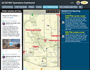
AZ ESF/RSF Operations DashBoard
Central dashboard for all current events requiring state and county-level emergency management. For wildfire incidents posted through the AZ Dept. of Forestry & Fire Management and InciWeb, select “ESF 4-Firefighting DFFM” tab at the top. For wildfire potential, select “EFS 8 -ADHS Prepardness” tab at the top.
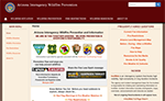
Arizona Interagency Wildfire Prevention & Information Website
Federal and state agencies in Arizona provide timely, accurate fire and restriction information for the entire state.
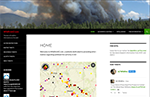
WildfireAZ.com
A central hub for information on wildland fire activity in Arizona, includes maps and feeds.

Arizona Emergency Information Network
The State of Arizona’s official source for emergency updates, preparedness advice and hazards information, and related resources.
Nationwide
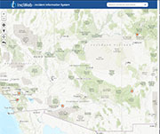
InciWeb
Shows current wildfire locations on an interactive map. InciWeb is a highly reliable source as it is updated directly by professionals overseeing emergency events. Learn more at the “Help” page.
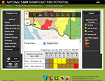
National 7-Day Significant Fire Potential
Provides a map that shows the national 7-day significant fire potential by region.
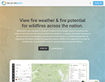
WildfireSAFE
View fire weather & fire potential for wildfires across the nation.
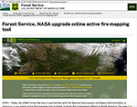
Forest Service, NASA Upgrade Online Active Fire Mapping Tool
Online active fire mapping tool that provides wildfire management teams and the public real-time access to data, maps and visualizations of active wildfires across the nation.